


ANAFI Ai integrates a 4G wireless module (in addition to its Wi-Fi radio) that allows it to transmit 1080p video with extremely low latency (300ms) anywhere, without range limitations. 
Combined with a routing algorithm, the connection between the drone and its controller is maintained even during significant Wi-Fi interruptions: if the effective Wi-Fi throughput (goodput) is below 1.5 MBps, the system automatically switches to 4G.
To limit mobile data consumption when the pilot is within range of the drone's Wi-Fi network, the transition from 4G to Wi-Fi is also performed automatically without cutting the video stream.
ANAFI Ai connects to the 4G Remote Control in under 30 seconds if the drone is not within Wi-Fi range, and in under 15 seconds if the drone is within Wi-Fi range.
Automatic Network Switch
4G and Wi-Fi network quality and capacity are measured every 100ms to adapt streaming to network conditions.Combined with a routing algorithm, the connection between the drone and its controller is maintained even during significant Wi-Fi interruptions: if the effective Wi-Fi throughput (goodput) is below 1.5 MBps, the system automatically switches to 4G.
To limit mobile data consumption when the pilot is within range of the drone's Wi-Fi network, the transition from 4G to Wi-Fi is also performed automatically without cutting the video stream.
ANAFI Ai connects to the 4G Remote Control in under 30 seconds if the drone is not within Wi-Fi range, and in under 15 seconds if the drone is within Wi-Fi range.
Omnidirectional Transmission System
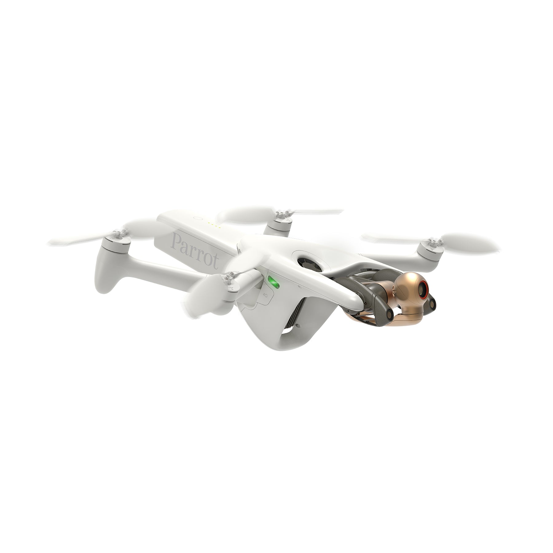
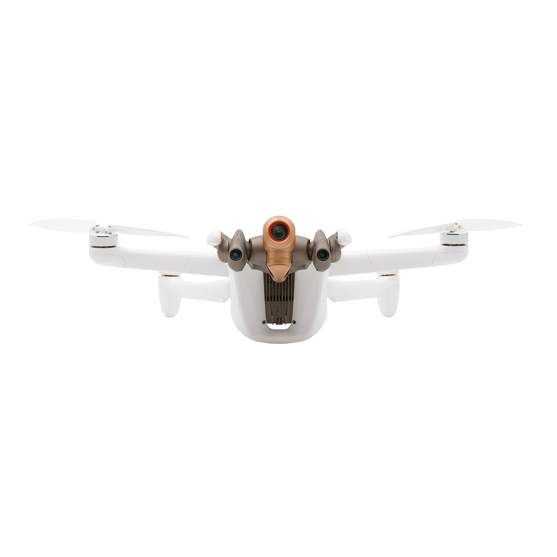
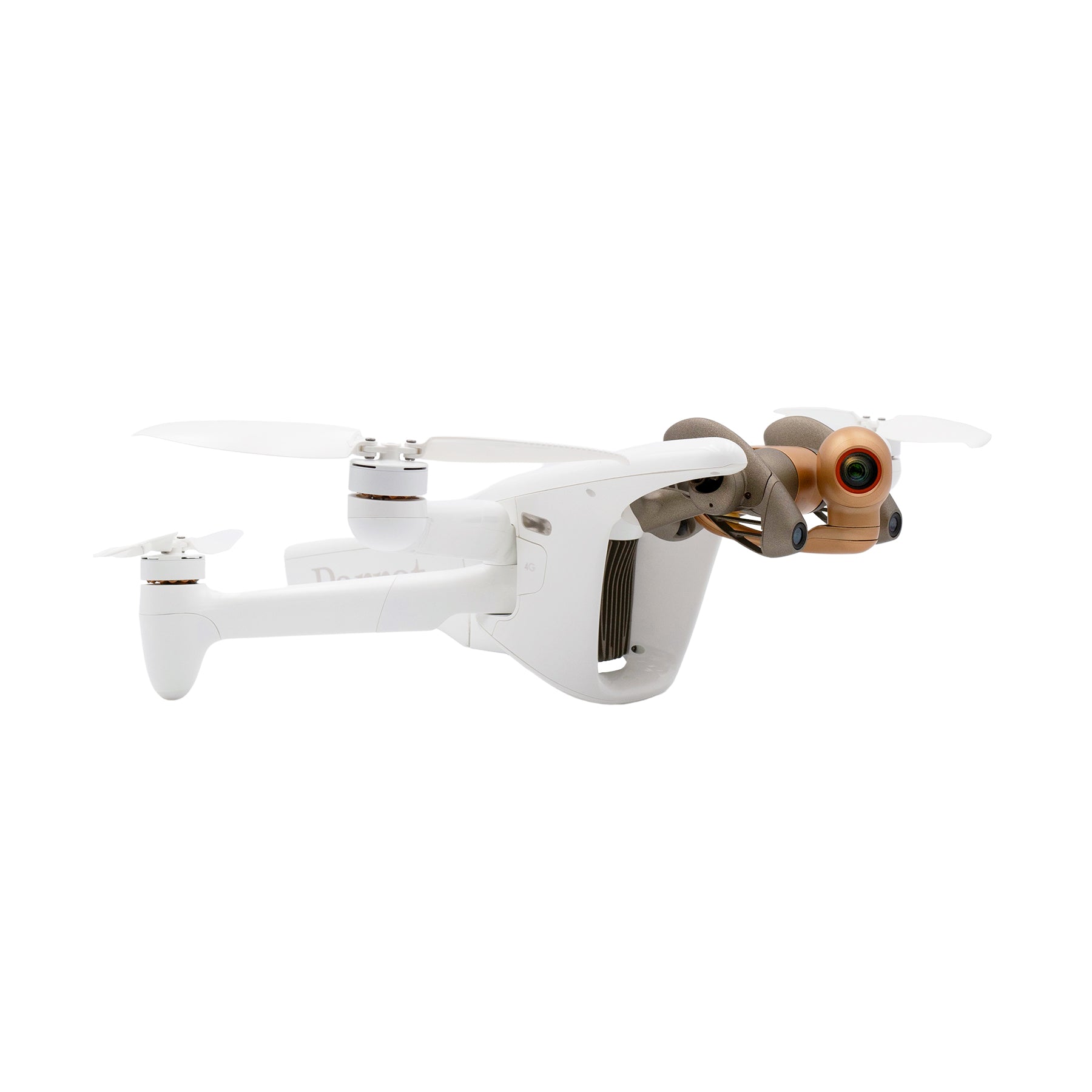
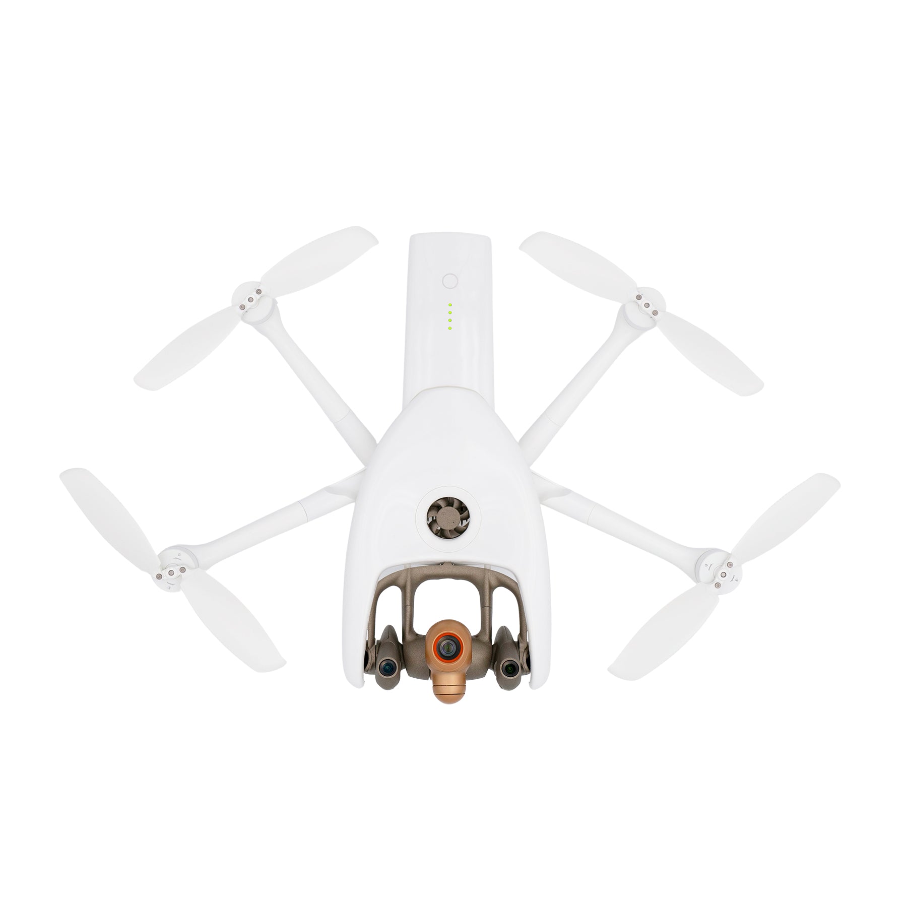
ANAFI Ai has four directional antennas with reflectors (gain: 2.5 dBi per antenna). The drone determines the optimal antenna pair depending on its orientation and position relative to the pilot.Video Streaming
| resolution | up to 1080p |
| Frame rate | up to 30fps |
| Bitrate | Up to 8Mbit/s |
| Video Encoding | H.264/AVC |
| protocol | RTP Streaming with RTSP Session Management |
| Latency | 300 milliseconds |
 ANAFI Ai's sensor supports high pixel count, enabling high-resolution aerial photography.
It uses a "Quad Bayer" color filter array, in which four adjacent pixels have the same color, and by adding the signals from the four adjacent pixels, it is possible to capture HDR images and videos in real time.
The dynamic range is approximately four times greater than that of conventional Bayer arrays, allowing you to capture even the most challenging scenes with minimal blown-out highlights and loss of detail in shadows.
 The ANAFI Ai Lens is specially designed for Parrot and features six aspherical lenses optimized for low optical flare.
This lens offers HFoV 68° in standard video mode and HFoV 64.6° in standard photo mode.
 When recording video in HDR8 and HDR10, ANAFI Ai covers a dynamic range of 14EV.
HDR10 is a format with a maximum brightness of 1,000 nits and a color depth of 10 bits, offering a palette of 1 billion colors compared to the 16 million colors of the standard dynamic range.
Compared to HDR8, HDR10 offers more than twice the brightness and a corresponding increase in contrast. While HDR8 can be displayed on standard screens, HDR10 is designed for HDR10-compatible TVs and screens. Zoom is available in all photo and video modes, and the 48MP sensor combined with a precise sharpening algorithm ensures high-resolution still images, even when using 6x digital zoom.
ANAFI Ai users can see centimetre-sized details from up to 75m away.
Because of its high pixel count, even if you crop a 4K video to 1080p, the image quality will hardly deteriorate.

Designed for inspection and mapping
Combining AI and visual inspection
Combining the drone's artificial intelligence with the PIX4Dinspect online platform allows users to perform inspections faster and more efficiently than ever before. Machine learning algorithms recognize tower antennas and extract their dimensions, height, dip angle, azimuth and vertical angle.Best-in-class sensor
ANAFI Ai is equipped with a 48MP 1/2" CMOS sensor with a Quad Bayer color filter pattern, making it particularly suitable for inspection and photogrammetry. It can capture high-resolution images with a wide dynamic range.55% more detail compared to 1" sensor
 The 1/2" Quad Bayer 48MP sensor delivers sharpness that exceeds that of the 1" 20MP sensors found in some professional drones, as can be seen in the image above, taken during a roof inspection mission at the same altitude.
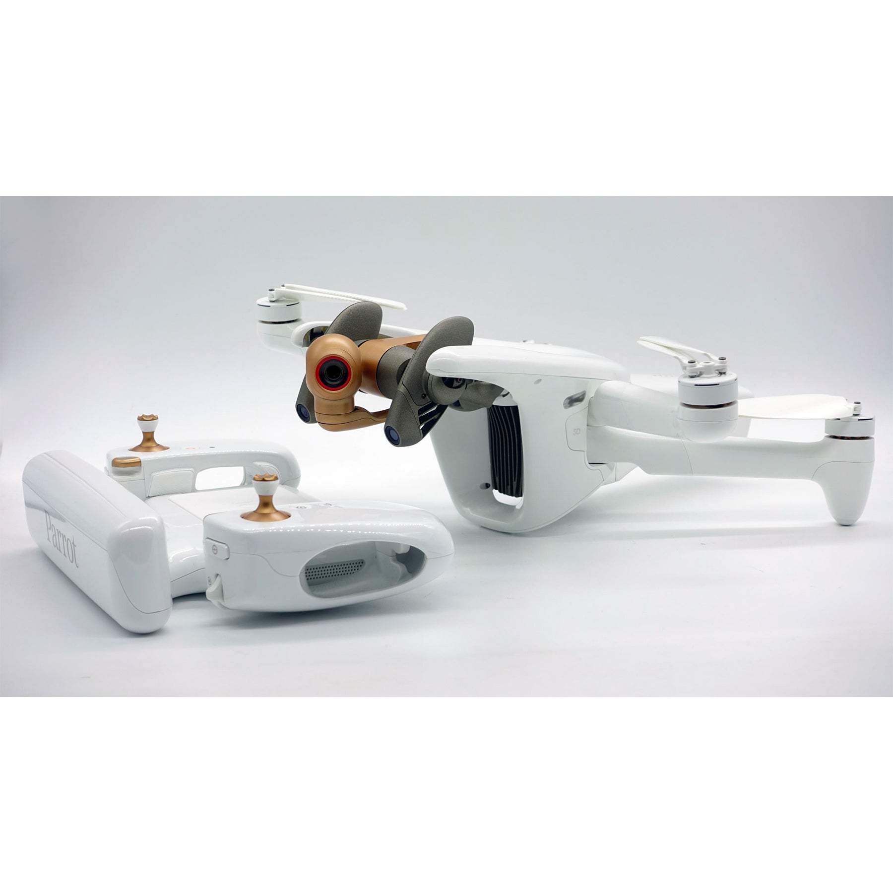
180° control gimbal ideal for inspection
The ANAFI Ai gimbal is equipped with a 6-axis hybrid (mechanical + electronic) image stabilization system that compensates for vibrations during flight for sharp footage. ANAFI Ai's camera can be controlled from -90° to +90°, making it an ideal aerial imaging tool for inspecting the underside of bridge decks.Survey-grade accuracy
| ANAFI Ai | Phantom 4 Pro v2 | |
| Image Width (px) | 8000 | 5472 |
| Image height (px) | 6000 | 3648 |
| Sensor width (mm) | 6.4 | 13.2 |
| Sensor height (mm) | 4.9 | 8.8 |
| GSD at 30m (cm/px) | 0.46 | 0.82 |
Harnessing the power of AI and 4G
Execute any flight plan in one app
Surveying, inspection, photogrammetry and more – all missions can be carried out from FreeFlight 7. Grid, Double Grid and Circular missions from the flight planning app PIX4Dcapture are now integrated into the flight app ANAFI Ai. Create a flight plan with a single click. Simply click on FreeFlight's 3D interactive map to instantly scan buildings.
Artificial intelligence automatically defines optimal flight parameters and trajectory, while 48MP images precisely geotagged by ANAFI Ai sensors (IMU, GNSS, Time of Flight) enable precise 3D reconstruction.
ArcGIS is the powerhouse behind the mapping in FreeFlight 7. The 3D representation is based on OpenStreetMap data covering cities all over the world. Automatic flight plans are created with one click on a 3D cadastral system. The perception system ensures the safety of your flight plans. Users don't need to worry about obstacles: ANAFI Ai will avoid them autonomously.
Autonomous Flight
ANAFI Ai's uniquely designed obstacle avoidance sensing system is based on stereoscopic vision and automatically orients itself in the direction of travel. The drone detects obstacles up to 30 meters (100 feet) away. While executing a flight plan, artificial intelligence technology (AI) continuously builds and updates an occupancy grid, which represents the drone's environment in voxels. The algorithm determines the optimal trajectory to avoid obstacles, allowing the drone to focus on its mission.
4G connectivity
ANAFI Ai is the first commercial micro drone equipped with a 4G module, covering over 98% of the world's frequencies. [Example of high-voltage power line inspection]
Captured with ANAFI Ai and processed with Pix4Dmatic.
Scene size: 4060 x 60 x 70m (13,320 x 200 x 230ft), number of images: 2,172, GSD: 1.3cm/px, altitude: 90m, front/side overlap: 90% / 65%
Your drone will seamlessly switch from Wi-Fi to 4G or from 4G to Wi-Fi, prioritizing the strongest connection. This ensures:
Optimizing Flight Time
ANAFI Ai's imaging specifications enable significant time savings.
4G transfer to PIX4Dcloud
In the process of creating a digital twin from UAV aerial images, file transfer and photo processing are two time-consuming tasks, and ANAFI Ai can help speed up your workflow.
Compatible with PIX4D Suite
Photogrammetry application suite for mobile, desktop and cloud
Photogrammetry/LIDAR
Why choose photogrammetry for surveying and inspection?
Aerial photogrammetry is an excellent choice when you need to visually interpret the data, in addition to its affordability and ease of use. [In photogrammetry]